
LandGlide
Comprehensive Parcel Data and Property Line Mapping App
Description
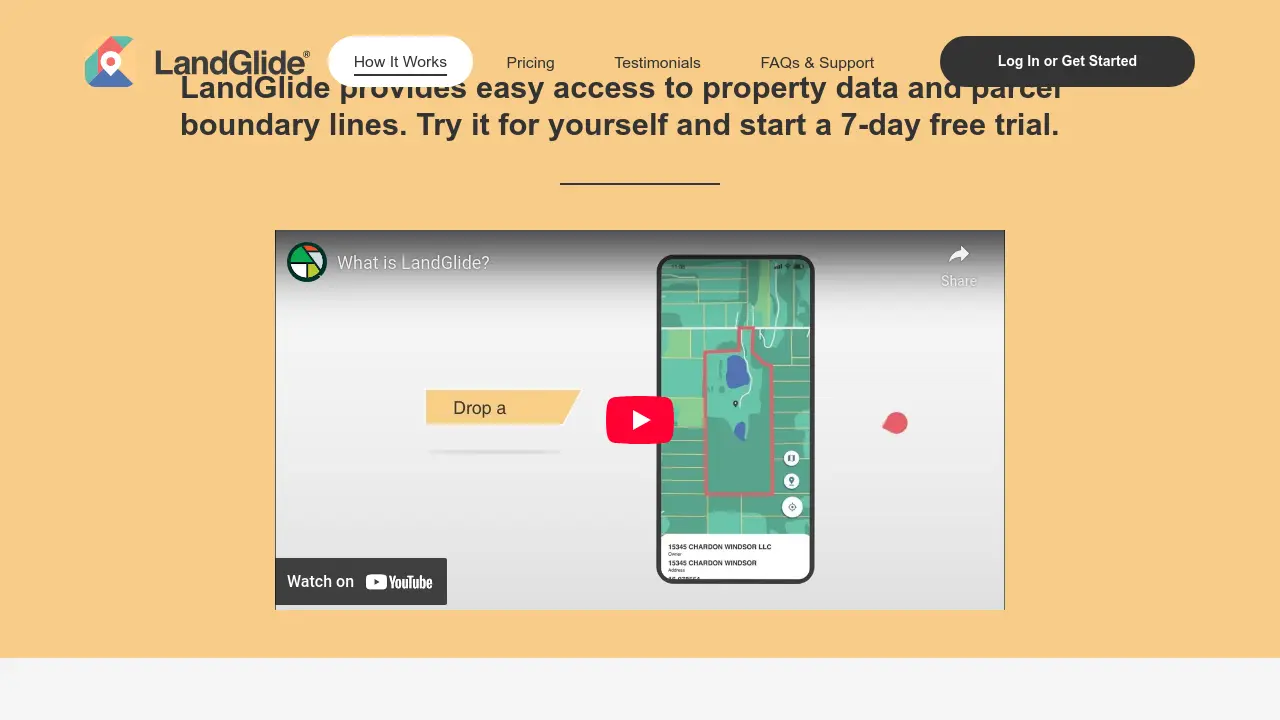
LandGlide gives users instant access to detailed property data and interactive parcel boundary maps, utilizing GPS technology to pinpoint locations anywhere in the United States. With coverage spanning more than 99% of the U.S. population, users can explore property ownership details, addresses, acreage, sale history, and more on any device.
The application offers both online and offline access, allowing users to save favorite properties, add notes, and export data. Built for efficiency and thoroughness, LandGlide is well-suited for users needing reliable, up-to-date land and property information for personal or professional purposes.
Key Features
- Extensive Parcel Coverage: Access parcel data for over 157 million properties in 3,200+ U.S. counties
- Live GPS Integration: Pinpoint user location to display parcel boundaries and data in real time
- Detailed Property Information: Instantly view property owner, address, acreage, sale price, and transfer date
- Online and Offline Access: Use property and parcel data with or without an internet connection
- Favorites and Notes: Save favorite properties and add personal notes for quick reference
- Data Export: Export selected parcel and property data for further analysis
- Cross-Device Compatibility: Use LandGlide on both mobile and desktop platforms
Use Cases
- Property management and record-keeping
- On-site real estate evaluation and field work
- Locating property corners and boundaries
- Land and asset management for large portfolios
- Accessing and verifying property ownership information
- Agribusiness land assessment and planning
You Might Also Like

Microsoft™ Text-to-Speech Downloader
FreemiumDownload Microsoft synthesized Text-to-Speech audio with 1 click.

Timely
Free TrialAI-Powered Automatic Time Tracking for Accurate Business Insights

Boa
Contact for PricingThe World's First AI Copilot For Mobile Game Marketers

MeasureSquare
Free TrialEstimate Smarter, Bid Faster, Win More!

LlamaCloud
Usage BasedIntelligent Document Processing, Extraction, and Indexing, Powered by LlamaIndex